


OVERVIEW: On May 29, Read more [...]
Crowl Creek CU-AU-Pb-Zn Project
Project Category: Development
-
Contact: Dominique Stewart
Company Name: Kidman Resources
Telephone Number: +61 3 9671 3801The Crowl Creek Project is located approximately 25km NW of Condobolin, New South Wales, comprising of 5 granted exploration leases. The project lies in the southern extent of the Cobar basin which hosts deposits such as the Hera and Nymagee Mines (YTC Resources), further north east the Peak Mine (New Gold) and CSA Mine (Glencore), and positioned adjacent to the tenements is the Cu/Pb/Zn/Au deposit of Mineral Hill (KBL Resources). The project contains the Murrays Mine gold prospect, which remains open north, south and down dip and the historic Blind Calf copper oxide workings and production centre just 4km west of the Mineral Hill Polymetallic Mine.
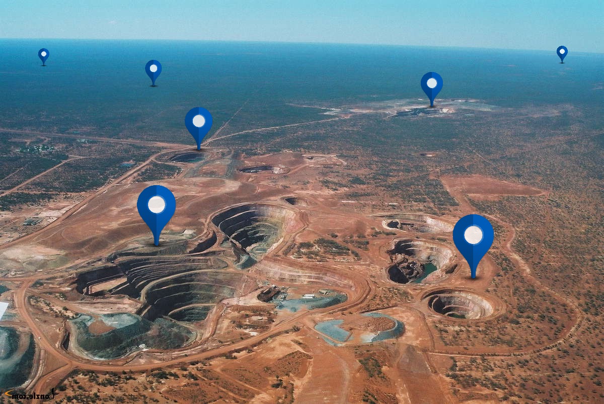
Project Image: Rock Chip samples from the Wilmatha Cu Project EL7538 in Crowl Creek
The Crowl Creek Project comprises Exploration Licence EL7538, EL7806, EL7820, EL7537 and EL7523 and is 100% owned by Kidman Resources. The Crowl Creek Project is located approximately 25 km northwest of Condobolin, in Central-West New South Wales. Access to the tenements is by sealed roads from Condobolin, a small town approximately 460km west of Sydney in NSW, Australia.
Blind Calf Project
The discovery of copper mineralisation at Blind Calf Field was made in 1908. The principal workings, the Blind Calf mine, consist of a group of shafts sunk to depths of 15 to 30 metres with at least two connected by a drive at 22.5 metres. South of the Blind Calf, the Engine Shaft was sunk to a depth of 45 metres, and Dunbar’s and Nuttal’s shafts to depths of 45 metres and 60 metres respectively. Recorded production from 1909 to 1919 from the workings is approximately 100 tonnes of copper oxide ore for an estimated 20 tonnes of copper and includes a small leaching operation in 1958 and 1959 (McClatchie, 1968).
Australian Oil and Gas Minerals Pty Ltd (A.O.G.)
A.O.G. carried out detailed mapping, dump auger sampling, stream sediment sampling, costean rock chip sampling and shaft inspections (measuring shaft dimensions, depths, lode widths and orientations) during 1968 and 1969. It was estimated that 10,500 long tons of ore at an average grade of 6.3% Cu remained.
Horizon Explorations Pty Ltd.
In 1970 Horizon Explorations evaluated the prospect to clarify the configuration of structural elements which were thought to control mineralisation. This work initially involved detailed prospect geological mapping in and around the old workings, as well as chip sampling of drives and stopes where accessible. Rock chip sampling over the prospect tested the significance of anomalous costean rock chip samples obtained by A.O.G. Minerals.
The Blind Calf prospect lies within highly deformed Ordovician Girilambone Group metasediments with narrow Silurian porphyritic rhyolite bodies metamorphosed to lower greenschist facies. The Girilambone Group rocks comprise schistose meta-siltstones and fine to medium grained schistose meta-sandstones with interbedded quartz-mica schists. The poor sorting and generally angular grain shape of the coarser grained rocks indicate a short transportation distance and an acid igneous provenance. The mineral assemblage consists of quartz, biotite, muscovite (major), albite, microcline, chlorite (minor) with accessory minerals of hematite, magnetite, rutile, zircon, tourmaline and apatite.
A tectonic history of the area was constructed but a rigorous interpretation was not considered possible owing to a lack of stratigraphic markers. The sequence of events, in order of decreasing age, was interpreted as transposed bedding defined by a boundary between dissimilar rock units (as lenticular pods) and traceable only over very short distances and with no stratigraphic significance.
Numerous narrow quartz veins, from 2mm to 12mm up to 30cm, within the meta-sediments were believed to be metamorphic segregation products or were injected along cleavage and fracture planes. Several large milky quartz ‘blows’ were noted in the northwestern area of the prospect. Faulting in the area was regarded as minimal, however, the presence of large quartz veins and blows (as well as unidentified, but non-coincident ground magnetometer linears) suggested large scale faulting may be present. Joint sets with spacings from 50mm to 150mm show wide variation, but were believed to be generally steeply dipping with dominant strike directions of 345° and 010° magnetic.
Two outcropping porphyritic bodies within the prospect area were mapped as an ‘eastern’ unit averaging 10 metres in width, striking 340° magnetic, and a ‘western’ unit (13 to 35 metres in width) with an overall strike of 350° but with unknown dip.
The ore mineral assemblage within the oxidised zone is noted as comprising malachite, azurite, cuprite, limonite, chalcocite and some covellite. Records show that chalcocite was found at a depth of 15 metres in the Blind Calf Lode and at a similar depth in a drive in the Engine Shaft. Unaltered primary sulphides, recovered from Dunbar’s Shaft, contained disseminated chalcopyrite with minor pyrite in a gangue of predominantly granular quartz. Lodes within the oxide zone contain predominantly copper carbonate minerals within steeply dipping fractures surrounded by zones of weaker mineralisation more sparsely distributed along favourable cleavage planes.
Actual lode dimensions at the surface were difficult to ascertain and only the Blind Calf Lode and Windlass Lode were estimated at 32m and 18m respectively. At the time, the Blind Calf and Windlass shafts were still accessible and drives and stopes were mapped. Samples (within the oxide zone) from across the back of a stope in the Windlass Shaft, at a depth of 9.8 metres, assayed 2.7% Cu over an exposed lode width of 3.6m and in the Blind Calf shafts two faces assayed 5.6% Cu and 18.7% Cu over 2.4 metres and 2.1 metres respectively (no other assays are recorded).
Horizon collected 280 rock chip samples from outcrop over the prospect. An orientation line across the Blind Calf Lode was sampled at 6m intervals and a local threshold for copper of 180ppm was indicated with a primary dispersion (across the leached zone) of approximately 21 metres. Strong anomalies were obtained in the vicinity of the old workings but contamination was suspected. Small but significant anomalies were outlined west of the Blind Calf Lode, between the Windlass and E.
Bowkett’s Shaft, and south and west of Miller’s Shaft. A weak anomaly along a line of leached outcrop south of the Engine Lode (approximately 43 to 53m south of the shaft and 8m in width) assayed only 200ppm copper.
An IP survey was completed on three north-south and three east-west traverses across the area of the workings (Smart, 1970). The survey was dipole-dipole with a 61m spacing. This was interpreted by Orsatti (1970) and a number of IP anomalies were identified and which formed the basis of the first drilling program. The data was provided as a series of pseudo sections and the anomalous locations marked on a plan showing the traverses.
Drilling Programme Four diamond drill holes were drilled in late 1970 with down hole depths ranging from 93m to 122.8m. DDH1 encountered two zones of significant mineralisation (beneath Dunbar’s Shaft): · 7.43m @ 1.37% Cu from 62.5m, including 1.32m @ 5.82% Cu from 63.78m · 2.35m @ 0.99% Cu from 88.0m Mineralisation consisted of chalcopyrite and pyrite within brecciated quartz. A microscopic examination of a polished section from the ‘upper z ne’ showed minor enrichment of chalcopyrite to bornite and strong fracturing (suggesting post-ore deformation).
The results of this hole suggested copper mineralisation to be confined largely to zones of shearing and brecciation, but not to persist into the sediments as previously suggested in their first report. DDH2, drilled beneath the Engine Shaft, intersected disseminated pyrite (and minor chalcopyrite) from 28m to 74.87m in mainly biotite-rich zones but did not encounter copper-rich brecciated zones as in DDH1.
DDH3, drilled below DDH1, did not intersect significant mineralisation but confirmed the attitude of the rocks as dipping steeply to the west (70-75°). DDH4 targeted the strongest IP response in the first IP survey. It was drilled on purely geophysical grounds, as no mineralisation corresponding to this anomaly was evident on the surface. The source of the IP response was considered to be a possible southerly extension of the Blind Calf mineralisation. A narrow fracture containing malachite and azurite was intersected at a shallow depth (19.94m to 20.24m), but was not assayed. Deeper pyritic zones containing minor chalcopyrite showed evidence of leaching. The intersection was believed to be near the base of oxidation and not considered a reliable indication of possible copper content of this zone at greater depth.
A second drilling programme was conducted following a second IP (gradient array) programme, as well as a Self-Potential (SP) programme. The SP survey covered an area of 600m x 600m and the gradient array IP survey covered an area of 900m x 600m using 30m spacing between the potential electrodes. Five anomalous IP zones (designated A, B, C, D and E) were identified within a wider regional response. The interpretation was supported by the results of DDH2, which did not test anomalies detected in the second survey, but intersected disseminated pyrite, and also by DDH4 which penetrated partly through Zone B. The five anomalous IP zones were interpreted as possible lens-shaped south-westerly dipping bodies of limited strike length which generally came to within 30m of the surface. Zones A, B and C were of greater interest and Zones A and E could be joined by choosing a slightly lower threshold value (0.44 instead of 0.45) on percentage frequency effect contours. The Dunbar’s Shaft and successful DDH1, between Zones A and E were seen as further evidence for continuity. Six percussion holes were subsequently recommended in order to save time and expense. Percussion drilling, however, encountered abundant water at depths below 30m, and contamination of the samples was suspected, so the holes were completed by diamond core drilling.
PDH1, designed to test the full width of the strongest IP response intersected traces of disseminated pyrite (and chalcopyrite) throughout the hole which increased in the target zone (from 55m to 85m). No association of sulphide zones with bioite-rich zones was noted and quartz was present in only minor amounts. This hole intersected 0.91m @ 3.0% Cu from 83.2m.
PDH2, designed to further test the IP anomaly tested in PDH1. Only very weak mineralisation was encountered.
PDH3, designed to test the second strongest IP response and likely extensions of the Blind Calf Lode. The hole intersected sparse pyrite mineralisation throughout the hole with few traces of chalcopyrite. The hole encountered a narrow breccia zone with quartz and biotite schist fragments with abundant pyrite and lesser chalcopyrite from 83.74m to 85.34m for 1.6m @ 1.88% Cu.
PDH4, designed to test the third strongest IP response and ‘downward’ extension of mineralisation in Miller’s Shaft. No significant mineralisation was intersected apart from an interval of 1800ppm Cu from 27.4m to 28.96m with minor pyrite throughout.
PDH5 was not drilled, but was probably planned to test anomaly ‘D’ (below Nuttal’s Shaft) as an unused drill pad was identified at approximately 6392875mN, 494550mm,E.
PDH6, designed to test the fifth strongest IP response interpreted as a possible southerly extension of the strongest IP response. The hole intersected minor pyrite throughout, with occasional traces of chalcopyrite.
PDH7, drilled as a vertical hole between the two Dunbar shafts to enable further correlation between DDH1 and DDH3. The hole intersected strong mineralisation throughout with two zones that could be correlated with DDH1. Mineralisation was encountered in brecciated quartz veins (as in DDH1) with significant zones: 3.05m at 0.45% Cu from 18.29m; 3.05m at 0.93% Cu from 45.72m; 12.19m at 1.50% Cu from 51.82; and 18.29m at 1.18% Cu from 45.72m.
The mineralisation intersected by drill hole PDH1, however, related to an increase in chlorite content but was attributed to the shaly composition of the original host rock rather than any alteration. The genesis of the mineralisation was problematic but the more richly mineralised areas probably represent localisation of sulphides in structural loci. Although the source of the mineralisation was unclear the presence of marcasite (in a DDH1 polished section) and the nature of the vein quartz, where it occurs in mineralised zones, suggested a low temperature origin and probably formed close the surface and above the main mineralised target.
BP Minerals Australia Gold Pty Ltd, 1986
In 1986 BP Minerals Australia Gold Pty. Ltd. was exploring for epithermal gold deposits within the Mineral Hill Trough and considered the intermediate Babinda Volcanics as suitable host rocks for epithermal deposits. Their work included regional stream sediment and rock chip sampling along geological traverses while searching for mineralisation and alteration systems (Cooper, 1986). Bulk samples of 10kg (minus 4mm) from drainage catchments of approximately 4 – 6 km2 were analysed for gold by bulk cyanide extraction method (with a detection limit of 0.05ppb). Only two samples gave values above 1ppb and were not considered anomalous. The second highest regional survey assay of 1.35ppb Au (highest 1.36ppb) occurred in a creek ( 6390300N/495400E) draining the eastern flank of Mt. Susannah, approximately 2km south of the Blind Calf Field.
Another stream sediment sample, approximately 2km downstream of the main eastern drainage out of the Blind Calf prospect returned an assay of 0.52ppb Au (6392400N/496700E) and the main westward drainage, approximately 2km west, returned an assay of 0.45ppb Au (6391650N/492950E). Hence an upstream gold vector towards the Blind Calf prospect may be interpreted from these results. Rock chip samples taken by BP Mineral south of the main Blind Calf Field, in the vicinity of A. Bowkett’s Shaft (6392200N/495000E), returned assays of 0.3g/t Au, 10.8% Cu, 1453ppm Pb, 40ppm Bi and 6.35% Fe. Similarly, at 6392500N/494800E rock chip samples returned 0.05g/t Au, 19.8% Cu, 11ppm Ag, 1700ppm Bi, 28ppm As and 20.43% Fe. These positions are somewhat inconsistent with the differential GPS surveyed position (approx. 6392140N/495100E) and are probably inaccurate butare comparable with recent sampling results in this area.
In addition, BP Minerals analysed 59 intervals (from 0.89 to 6.32 metres, average 2.55 metres) from diamond holes DDH1, 2, 3 and 4 for gold and a suite of 27 other elements and oxides. Only in one interval (DDH1; 64.01-66.68m with 0.1g/t Au and 2.64% Cu) from all these samples was gold above detection limit (0.1 g/t). Generally while BP Minerals assayed intervals not assayed by Horizon, due to the wide down hole intervals used for the sampling the data does not add any further useful detail.
BP Minerals also compiled summary logs for the diamond holes and recognised siltstones, sandstones, minor black pyritic shales and possible andesitic volcanics that were all metamorphosed to at least greenschist facies.
Triako Resources Ltd
Compilation of previous exploration data indicated that most work had been done in the immediate vicinity of the Blind Calf Field, and exploration for gold had been limited. Mapping and surface sampling in the vicinity of the Blind Calf Field by Triako delineated copper, gold and silver anomalies associated with both the known mineralisation and with possible strike extensions. Triako completed six RC drill holes totalling 830 metres within the Blind Calf Field and these indicated limited continuity to the mineralised lodes, and generally low gold grades. However, a number of geophysical anomalies remained untested (Martin & Randell, 2000).
Regional stream sediment sampling detected a number of gold, copper, silver and arsenic anomalies, only some of which had been sourced. Ground checking of regional geophysical anomalies and known historic workings and prospects failed to reveal significant mineralisation, however a number of these areas remained unchecked by Triako.
Murrays Project
EL5755 – Triako Mines
Triako explored the Tarata project, which included the Murrays and Big Ben prospects, between 2000 and 2010. Work at Murray’s included soil sampling and RC drilling. At the end of the exploration period Triako concluded that mineralisation is open to the south of the southern gold and arsenic anomalies in soil sampling and that mineralisation is open at depth in the northern mineralised zone. Triako recommended further RC drilling at Murrays.
EL7522 – OZ Minerals Pty Limited
OZ Minerals, on LE7522 conducted, data review, land access negotiation, ground gravity surveying, ground magnetic surveying, helicopter-borne EM and diamond drilling at the Pygmy’s Hill prospect.
The ground gravity, ground magnetic and helicopter-borne EM surveys were completed in order to investigate a linear magnetic anomaly in the west of the tenement. The ground magnetic survey was abandoned due to excessive cost, and the airborne EM failed to locate any conductors. The results of the ground gravity survey produced several targets, one of which was drill tested.
Two diamond drill holes were completed. The aim of the first was to investigate a gravity anomaly and the second to investigate a magnetic anomaly. The magnetic anomaly was determined to be caused by a monotonous sequence of siltstone with up to 2% pyrrhotite through its entire length. The gravity anomaly was determined to be caused by lithological density contrast. Mineralisation was not observed in either drill hole.
Initial review of a regional aeromagnetic dataset identified a north-south trending linear magnetic feature in the western portion of this tenement as a prospective target. The magnetic feature contains several historic prospects including Mooney’s and Norton’s prospects. Whereas both of these features are distinguished by discrete magnetic highs, the most intense of these is the Mooney’s prospect. This feature was the highest priority drill target identified during the data review process.
Of secondary priority in EL7821 is a region in the east of the tenement that comprises volcanic rocks of the Mineral Hill Canbelego Rift Zone. Regional magnetic data indicates some complexity within this area.
A local agent was engaged in to visit landholders and begin land access negotiations. Initially, in the first few months of the licence, focus was on the land in the vicinity of the Mooney’s magnetic feature. Drilling compensation agreements were sought from two landholders, Peter Mooney and Dudley Norton. An agreement was completed with Dudley Norton, however Peter Mooney pulled out of negotiations after several draft agreements had been presented to him. He denied further access to his property and it is unlikely that he will agree to the terms of an agreement in the near future.
When access agreements were in place over the Mooney’s magnetic feature landholders elsewhere in the tenement were approached for access agreements. In total, 25 landholders have property that is covered by EL7821. Three landholders have denied access to their land. These landholders will be approached again at a later date as some of the inaccessible areas contain prospective targets, such as the Mooney’s Prospect.
Work completed on the Murrays Project comprised geological and grade isosurface modelling of the Murrays Mine mineralisation and the planning of an RC programme, with the goal of determining the tenor of mineralisation to the north-west of the current shallow pit.
Geological modelling indicates the mineralisation at Murray’s is hosted predominantly within a single large quartz vein with short range splays also carrying narrow intervals of mineralisation. The highest grades are clearly located at surface, where supergene enrichment has occurred. A plunge control on higher grade primary Au mineralisation is also inferred, but the drilling density too low to allow a clear determination.
The Crowl Creek Project comprises Exploration Licence EL7538, EL7806, EL7820, EL7537 and EL7523 and is 100% owned by Kidman Resources.
The Crowl Creek Project is located in the southern end of the Cobar Basin, which is an inverted Late Silurian- Early Devonian basin within the Central Sub Province of the Lachlan Orogen (Glen 2005). The basin comprises three deep water troughs; the Cobar Trough to the north and Mt Hope and Rast Troughs in the south. These are flanked by coeval shallow water shelves; the Winduck Shelf to the west and north of the basin, the Walters Range and Mt Hope Troughs in the south, and the Kopyje Shelf on the eastern margin of the basin (David, 2006).
The Cobar Basin evolved in two phases; an early active syn-rift phase characterised by rapid deepening and active faulting, and a passive post-rift or sag-phase which was characterised by less active sedimentation and the development of shelf facies (Glen 1990). Basin formation was inferred by Glen (1990) to have developed during left lateral transtension. Basin inversion is interpreted to have occurred in the late Early-Devonian, under a right-lateral transpressional regime.
Sedimentation within the deep-water troughs is dominantly siliciclastic facies in the Cobar Trough to the north, and submarine volcanic facies to the south in the Mt Hope and Rast troughs. Sub-aerial volcanic components occur in the north and east of the basin. The Canbelego-Mineral Hill Belt consists of shallow water felsic volcanics separate to, but located within, the Kopyje Shelf. Whereas the Winduck Shelf and its equivalent Walters Range Shelf are dominated by sands siliciclastic sediments, the Kopyje shelf is composed of siliciclastic sediments and limestone.
It is commonly accepted that mineralisation occurred as inversion of the basin took place (Lawrie and Hinman, 1998). Mineral deposits in the Cobar Basin occur mainly within syn-rift phase sediments along a narrow corridor along the eastern edge of the basin. Most deposits close to the town of Cobar occur within the Nurri Group metasediments. The CSA and Endeavour deposits are hosted within the lower part of the Amphitheatre Group and the Nymagee and Hera deposits within transitional sediments between the Mouramba Group and the lower Amphitheatre Group (David, 2006)
Cobar-Type Deposits
The mineral deposits of the Cobar Basin are classified as a distinct deposit type on the basis of similar structural setting, shape and geometry, timing of formation, epigenetic character and conditions of deposition. However, a noteworthy difference between deposits is the variation in metal ratios across the field. This variation is reflected by a pattern of regional metal zonation from Au-Cu (Chesney, New Cobar) to Cu-Au (Great Cobar) and Au-Cu-Pb-Zn-Ag (Peak) in the south to Cu-Zn-Pb-Ag (CSA) and then Ag-Pb-Zn-(Cu) (Endeavour) in the north (Lawrie and Hinman, 1998).
Deposits show a very small footprint, yet have great depth extent. Ore lenses, or pipes, may be greater than 400m vertically, less than 100m laterally and less than 300m in strike length. They are elongate, sub-vertically plunging and localised on steeply dipping, linear, ductile high-strain zones. Structural controls, at a deposit scale, may be doubly plunging anticlinal fold hinges and fault jogs. At a regional scale, primary extensional structures and transfer faults and other basement heterogeneities may be the local for mineralisation.
Cobar deposits may contain magnetite, and, or, pyrrhotite, creating distinct “bullseye” magnetic features. Regional high strain zones on which the deposits occur are prominent features on high-resolution aeromagnetic images. Some deposits such as Hera, may be offset from “bullseye” features as they are associated with non-magnetic pyrrhotite, or may occur down-dip from “bullseye” features, such as at Peak (Lawrie and Hinman, 1998).
Geochemically, deposits may have alteration haloes up to 150m above and 1.5km lateral to blind deposits. Significant trace elements associated with deposits are Bi, As, Sb, Ni, Cd, Hg and Ba. Lateral depletion haloes may occur around deposits such as Li, Na, Rb and Sr depletion at CSA. Complex major and trace element haloes are developed around deposits. Zoned alteration envelopes may occur with outer zones (up to 1500m) characterised by destruction of detrital chlorite and albite and growth of ankerite+/- siderite +/- quartz + chlorite +/- pyrite, and inner zones (
-
Total Resource Estimate (M+I+I): CU, Au, Pb, ZN
-